IBM Compliant Drone Survey

Mining Survey
As Per IBM Standards

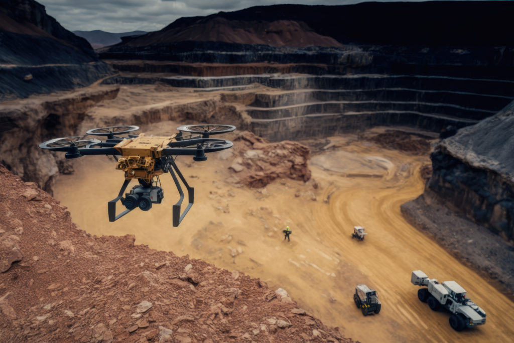
Accurate, IBM-compliant drone surveys for open-cast and underground mines — delivering volumetric analysis, 3D pit models, and statutory reporting data with precision and safety that traditional methods cannot match.

Mining aerial drone survey
Volumetric Analysis IBM Compliance Pit Mapping Dump Volume Calculation Slope Stability Analysis Progressive Mine Plans Statutory Reporting Volumetric Analysis IBM Compliance Pit Mapping Dump Volume Calculation Slope Stability Analysis Progressive Mine Plans Statutory Reporting
Service Overview

IBM-Compliant Drone
Mining Surveys

The Indian Bureau of Mines (IBM) mandates regular survey and volumetric reporting for all mining leases under the MMDR Act. Traditional manual surveys in active mines are slow, inaccurate, and pose serious safety risks to surveyors. Our drone survey solution delivers IBM-compliant data faster, safer, and at fraction of traditional cost.

Monthly IBM compliance surveys that previously took 5–7 days with traditional methods can now be completed in 1–2 days — with greater accuracy, full digital records, and zero risk to survey staff.

  • IBM & DGMS compliant survey reports
  • Accurate cut & fill volume calculations
  • Bench-wise 3D pit model generation
  • Overburden dump volume assessment
  • Slope angle measurement for stability analysis
  • No manned entry into hazardous pit areas
Indian Bureau of Mines CompliantMMDR Act | Mining Lease Survey Standards
Applications

Where We Apply This Service

Our mining drone surveys serve coal, iron ore, limestone, granite, and all other mineral extraction operations.

Open-Cast Mine Mapping

Comprehensive aerial mapping of open-cast mines — pit geometry, bench levels, highwall angles, and toe positions for IBM compliance and mine planning.

Pit Mapping IBM Reports
Volumetric Calculations

Precise cut-and-fill volume calculations for extracted mineral, overburden dumps, backfill areas, and stockpile inventory management.

Volume Stockpile
Progressive Mine Plans

Monthly or quarterly progressive mine plans as required under IBM regulations, comparing actual excavation progress against approved mining plans.

Monthly Plans Compliance
Slope Stability Monitoring

Regular monitoring of highwall and dump slopes to detect deformation, over-steepening, and early warning signs of potential slope failure events.

Slope Safety
Backfilling & Reclamation Survey

Volume monitoring of backfilling operations and mined land reclamation progress for MOEF/SEIAA compliance and forest clearance conditions.

Reclamation MOEF
Statutory & Mining Plan Reports

Complete statutory survey reports for IBM submission, mining plan revisions, lease renewals, and DGMS inspections in prescribed formats.

Statutory IBM Reports
How It Works

Our Mining Survey Process

Our mining survey process is designed for active mine environments — maximum safety, minimal disruption to operations, and IBM-ready outputs.
01
Mine Details & Scope Review

We review your mine type, lease area, IBM submission requirements, survey frequency, and previous mine plan data to design the survey scope.

02
Safety Assessment & Mine NOC

A pre-flight safety assessment is conducted with the Mine Manager. All operations follow DGMS safety protocols and DGCA airspace regulations.

03
GCP & Reference Benchmarks

Permanent benchmarks and GCPs are established using DGPS/Total Station and tied to the mine's survey grid for consistent repeat surveys.

04
Aerial Data Capture

UAV flights cover the pit, benches, dumps, and lease boundary. Dense overlap imagery ensures every face and working bench is captured completely.

05
3D Model & Volume Computation

Photogrammetric processing generates a high-density 3D surface model. Volumes are computed using TIN/Grid methods and cross-checked against reference surfaces.

06
IBM Report & Mine Plan Delivery

Statutory survey reports in IBM-prescribed formats, progressive mine plans, and all digital deliverables are provided within 48–72 hours.

What You Get

Survey Deliverables

Orthomosaic Map

High-res georeferenced mine area mosaic

3D Pit Model

Bench-wise 3D surface & pit geometry

Volume Report

Cut/fill & stockpile volume calculations

Progressive Mine Plan

IBM-format progressive survey plan

Contour Map

0.5m / 1m interval mine contours

Statutory Report

IBM/DGMS format compliance report

Technical Specs

Equipment & Accuracy

UAV Platform: Multi-rotor UAV with RTK GPS
Sensor: 20MP RGB
Horizontal Accuracy: ±5–10 cm with GCPs
Vertical Accuracy: ±8–15 cm with GCPs
Volume Accuracy: ±1–3% of total volume
Coverage: 150–200 hectares/day
Output Formats: DXF, PDF, LAS, GeoTIFF, CSV
Standards: IBM, MMDR Act, DGMS, MOEF compliant
Frequently Asked

Mining Survey FAQs

Is your drone survey accepted by IBM for statutory compliance?
Yes. Our surveys use DGPS-controlled photogrammetry that meets IBM prescribed accuracy standards. Reports are prepared in IBM-accepted formats with all required certifications by licensed mine surveyors.
How often should mines conduct drone surveys?
IBM typically requires quarterly or half-yearly progressive surveys, while operational requirements may call for monthly volume surveys. We offer flexible survey schedules to match your compliance calendar.
Can you survey deep open-cast pits safely?
Yes. Our multi-rotor UAVs can descend into deep pit sections with GPS-denied environments using visual positioning systems. All flights are planned to cover pit floors, benches, and highwalls completely.
What mineral types do you serve?
We serve all mineral types — coal, iron ore, limestone, bauxite, granite, sandstone, manganese, chromite, and all other major and minor minerals under the MMDR Act across India.
Can you help with mine lease renewal surveys?
Yes. We provide complete survey packages for mining lease renewals including boundary surveys, progressive plans, volumetric reports, and closure plan assessments as required by IBM and state DMGs.
Start Your Project

Need IBM-Compliant
Mining Survey?

Get a custom quote for your mine size and survey frequency. Fast turnaround, statutory-ready reports, nationwide service.