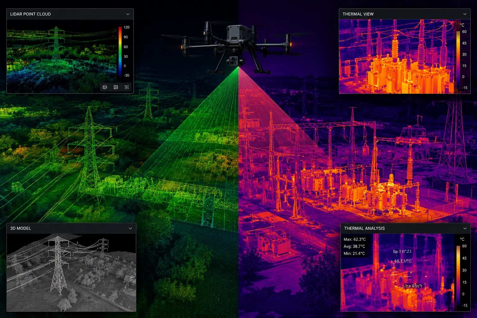
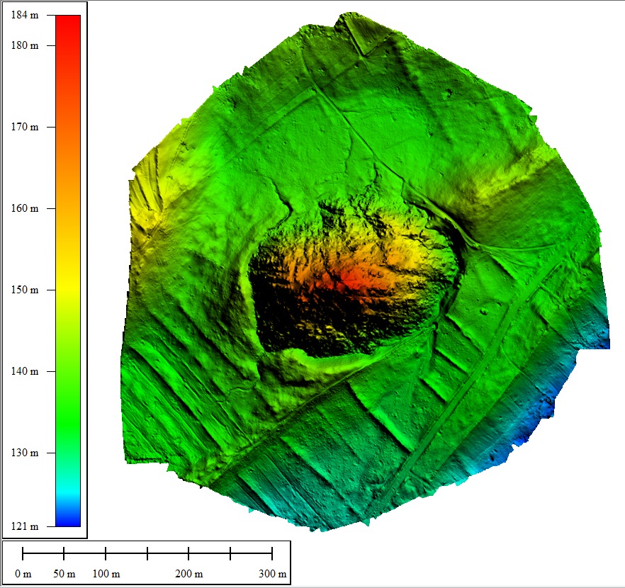
Next-generation aerial data capture using airborne LiDAR for dense vegetation terrain and thermal infrared for heat-based anomaly detection — where standard photogrammetry falls short, our advanced sensors deliver.

Each sensor serves different survey objectives — often deployed together for comprehensive data capture.
Light Detection and Ranging — fires 100,000s of laser pulses per second, recording multiple returns per pulse. Penetrates dense forest canopy to map the bare earth surface beneath. Delivers the most accurate DTM available from aerial platforms.
±2cm Accuracy · 200+ pts/m² · Canopy PenetrationUncooled and cooled IR cameras detect temperature differences as small as 0.05°C. Reveals heat signatures invisible to RGB cameras — subsurface moisture, electrical faults, structural failures, wildlife, and industrial process anomalies.
±0.5°C Sensitivity · 640×512 Resolution · Day/NightStandard drone photogrammetry produces excellent results in open terrain and clear-sky conditions. But two scenarios demand advanced sensors: dense vegetation (where photogrammetry cannot see through canopy to the ground) and thermal anomaly detection (where visible light reveals nothing but IR reveals everything).
LiDAR pulses can penetrate gaps in dense forest canopy to map the ground surface below — something photogrammetry physically cannot do. This makes LiDAR essential for surveys in forested, hilly, and urban tree-covered terrain.


True bare-earth DTM under dense forest cover for railway, road, and power line projects in hilly terrain — the only method that works through canopy.
Precise power line sag, clearance, and encroachment surveys — LiDAR captures individual conductors, pylons, and vegetation approaching danger zones.
Thermal inspection of industrial plant, electrical switchgear, substations, furnaces, and process equipment — detecting hot spots, failing components, and energy loss.
High-density LiDAR point clouds for precise urban 3D models — building heights, facades, rooftop equipment, and street-level features for smart city applications.
Thermal detection of subsurface moisture, seepage paths, and water ingress in dams, embankments, tunnels, and building envelopes.
Millimetre-accurate 3D documentation of heritage structures, archaeological sites, and monuments for ASI conservation and digital preservation.
We recommend the right sensor for your objective — LiDAR for ground mapping under canopy, thermal for anomaly detection, or both simultaneously for comprehensive data.
LiDAR and thermal sensors have different altitude and overlap requirements compared to RGB photogrammetry. Flight plans are optimised for maximum point density and thermal resolution.
LiDAR requires precise IMU calibration and a ground base station for trajectory accuracy. This ensures the point cloud georeferencing meets survey-grade accuracy specifications.
UAV-mounted LiDAR or thermal sensor captures data along planned flight lines. LiDAR fires millions of pulses, recording multiple returns per pulse through canopy gaps.
LiDAR point clouds are classified into ground, vegetation, buildings, and infrastructure. Thermal imagery is processed and calibrated for accurate temperature values.
Classified point cloud, bare-earth DTM, DSM, intensity images (LiDAR) or calibrated thermal orthomosaics and anomaly reports delivered within 72–96 hours.
Classified LAS/LAZ point cloud
Ground model under canopy
Surface model with structures
Calibrated thermal orthomosaic
GPS-tagged thermal anomalies
Full processing & accuracy report
Tell us your survey challenge — we'll recommend the right sensor and deliver a custom quotation within 24 hours.