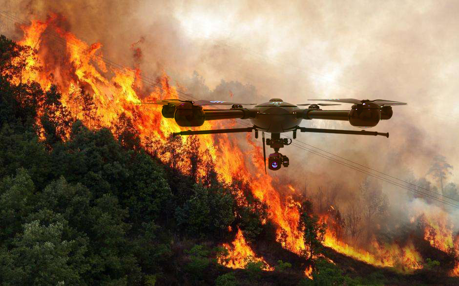
Rapid drone deployment for forest fire monitoring, flood damage assessment, landslide mapping, cyclone damage survey, and search-and-rescue support — delivering real-time aerial situational awareness when it matters most.
Real-time flood extent mapping, embankment breach location, stranded person detection, and post-flood damage assessment for SDMA and district collectors.
Active fire perimeter mapping with thermal drones, fire spread direction prediction, safe approach route identification for firefighting teams, and burn area damage assessment.
Slide extent mapping, debris flow volumes, blocked road and river identification, secondary hazard zone delineation, and victim search in inaccessible terrain.
Post-cyclone damage survey — fallen trees, collapsed structures, damaged power lines, and road accessibility assessment for rapid restoration prioritisation.
Post-earthquake aerial damage mapping, survivor thermal detection in rubble, and safe access route identification for NDRF search and rescue teams.
Safe aerial assessment of industrial accidents, gas leaks, and chemical spills — providing situational awareness for response teams without exposing them to hazardous zones.
Within 2 hours of receiving a request, our team is briefed on the disaster type, affected area, and specific information needs of the incident commander or EOC.
Drone team with appropriate sensor payload (thermal for SAR/fire, RGB for flood/damage assessment) is deployed to the incident site within 24 hours from anywhere in India.
DGCA has an emergency drone operation approval pathway for disaster operations. We handle all approvals under the UAS Rules 2021 emergency provision — typically within 2–4 hours.
Continuous flights with live video feed to the EOC. Real-time geotagged video enables the incident commander to direct response teams to exact locations on a map.
Daily processed maps — flood extents, fire perimeters, damage assessments — delivered as georeferenced KML/GeoTIFF files for integration into SDMA and EOC GIS systems.
Comprehensive damage assessment report with maps, statistics, and satellite-comparable data — ready for submission to state government and NDRF for resource reallocation and relief planning.
Real-time geotagged aerial stream
Georeferenced damage extent map
Fire / survivor thermal imagery
Before/after forest change analysis
GIS-ready damage extent files
SDMA-format assessment report
Pre-register your district or agency for rapid response — or contact us immediately for active emergencies. 24-hour deployment.