Critical Infrastructure Survey
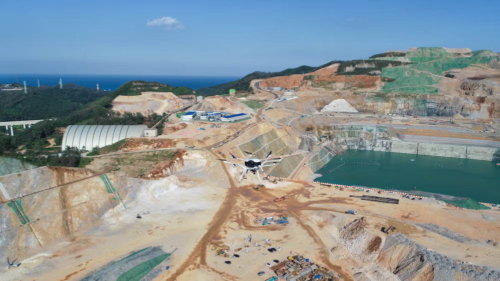
Dams & Hydropower
Drone Survey

Safe, precise aerial surveys for dam bodies, spillways, reservoirs, and hydropower infrastructure — capturing structural data, sedimentation levels, and catchment mapping with zero risk to field teams.

Dam aerial survey
Dam Body Inspection Reservoir Bathymetry Sedimentation Mapping Catchment Area Survey Spillway Inspection Seepage Detection Structural Monitoring Dam Body Inspection Reservoir Bathymetry Sedimentation Mapping Catchment Area Survey Spillway Inspection Seepage Detection Structural Monitoring
Service Overview

Why Drone Survey for
Dams & Hydropower?

Dam inspection traditionally requires dangerous rope access, scaffolding, or boat-based surveys — exposing engineers to significant safety risks. Our drone solution captures detailed visual and thermal data of dam faces, spillways, and intake structures with no personnel working at height or on water.

A comprehensive dam face inspection covering 500m of wall that takes a rope-access team 2–3 weeks can be completed by our drone in 1–2 days — with higher resolution imagery and zero safety incidents.

  • Full dam face, crest, and downstream slope survey
  • 2 cm crack and defect detection capability
  • Thermal imaging for seepage and wet patches
  • Reservoir sedimentation and water spread mapping
  • Catchment area DEM for hydrology studies
  • CWC, BIS, and DRIP programme compliant
Applications

Where We Apply This Service

Dam Face & Body Inspection

Close-range photogrammetric inspection of gravity, arch, and earthen dam faces — crack mapping, spalling, joint leakage, and surface deterioration analysis.

StructuralCracks
Reservoir Sedimentation Survey

Water spread area mapping, delta formation tracking, and sedimentation analysis for reservoir capacity assessment and desilting planning.

SedimentationCapacity
Catchment Area Mapping

High-resolution DEM of catchment areas for hydrological modelling, flood frequency analysis, and inflow estimation for hydropower projects.

HydrologyDEM
Hydropower Infrastructure Inspection

Penstock, powerhouse, intake structures, and transmission line inspection for hydropower plants in remote and inaccessible terrain.

PenstockPowerhouse
Seepage & Thermal Anomaly Detection

Thermal drone inspection detects seepage zones, wet patches, and piping initiation on dam faces and downstream slopes before they become critical.

ThermalSeepage
Spillway & Stilling Basin Survey

Detailed inspection of spillway chutes, energy dissipators, stilling basins, and flood channels for erosion, cavitation damage, and joint failures.

SpillwayErosion
How It Works

Our Survey Process

Designed for safety-critical infrastructure — all operations are coordinated with dam authorities and follow CWC safety protocols.
01
Authority Coordination & NOC

We coordinate with dam operating authorities, obtain necessary NOCs, and review dam drawings, previous inspection reports, and known defect areas.

02
Flight Planning & Safety Zones

Detailed flight paths are planned for dam face, crest, downstream slope, and reservoir — with safe buffer zones from powerhouse and intake structures.

03
Multi-Sensor Data Capture

Simultaneous RGB and thermal capture at 2–5 cm GSD for the dam body, plus wide-area mapping of reservoir and catchment at appropriate resolutions.

04
3D Model & Defect Mapping

Photogrammetric processing generates high-density 3D models. Defects are identified, classified, and mapped with GPS coordinates and dimensions.

05
Thermal Analysis

Thermal imagery is analysed for seepage zones, wet patches, temperature anomalies, and potential piping zones on the dam body and abutments.

06
Inspection Report Delivery

Comprehensive dam inspection report with defect maps, 3D models, thermal analysis, and prioritised maintenance recommendations — within 72 hours.

What You Get

Survey Deliverables

Orthomosaic Map

High-res dam & reservoir mosaic

3D Dam Model

Detailed 3D surface model of dam body

Thermal Report

Seepage & thermal anomaly analysis

Defect Map

GPS-tagged crack & defect inventory

Catchment DEM

Digital elevation model for hydrology

Inspection Report

CWC-format dam inspection report

Technical Specs

Equipment & Accuracy

UAV: Multi-rotor, GPS + obstacle avoidance
Sensor: 20MP RGB
Crack Detection: 2–5 mm at close range
GSD: 1–3 cm/pixel for dam face inspection
Thermal Sensitivity: ±0.5°C NETD
Formats: PDF, GeoTIFF, DXF, LAS, TIFF
Standards: CWC, BIS 4999, DRIP compliant
Frequently Asked

Dam Survey FAQs

Can you inspect dams while they are operational?
Yes. Drone inspections are conducted without interrupting dam operations. We coordinate with dam authorities to define safe flying zones around powerhouse intakes and spillways.
Can drones detect subsurface seepage?
Thermal drones detect temperature anomalies caused by seepage on dam faces and downstream slopes. While not subsurface, these thermal signatures reliably indicate seepage zones requiring further investigation.
How small a crack can the drone detect?
At close-range inspection altitude of 5–10m, our 42MP camera system achieves 1–3 mm/pixel resolution, capable of detecting cracks as fine as 2–5 mm in width reliably.
Can you survey remote hydropower projects?
Yes. Our team is equipped for remote deployments in hilly and mountainous terrain. We operate under DGCA regulations across India including high-altitude hydropower projects in Himachal, Uttarakhand, and the Northeast.
Do you provide DRIP programme compatible reports?
Yes. Our inspection reports are structured to meet Dam Rehabilitation and Improvement Project (DRIP) documentation requirements and CWC's dam safety guidelines.
Start Your Project

Need a Dam &
Hydropower Survey?

Share your dam details and get a custom quotation within 24 hours.